

Post by Peter Bakwin on Jun 14, 2013 14:19:53 GMT -5
Bruce "Buck" Nelson appears to be the only person to thru-hike the entire Desert Trail, 132d0h25m from Mexico to Canada, March 1 - July 11, 2012.
For a long time the desert was just looked at as the place where you dump waste, you put military bases, you run your motorbikes all over the place, you mine it and leave a big mess. It's important to get people to understand that the desert is a beautiful and complex place and also that it's a place that's worth preserving. There are very few people who will destroy a place through which they have just carried a 60-pound pack for three days. - guidebook author Steve Tabor
The Desert Trail is more of a route than a trail. Conceived by Russell Pengelly, the Desert Trail Association (later in collaboration with the Desert Survivors) worked to develop the route with the ultimate goal being a National Scenic Trail from Mexico to Canada. The official route currently runs from the California-Mexico border through California and Nevada, and ends in southeastern Oregon, around 1500 miles total. Nelson hiked the route, then continued on via a route of his own design through Oregon, Washington and Idaho, to the border with Canada, a total of 2223 miles. Nelson pre-set dozens of food and water caches for the first 1000 miles, returned (by car) to the Mexico border to retrieve the caches, then laid out 20 more caches in northern Nevada and part of Oregon.
Nelson provided the following useful links about his hike and the Desert Trail:
bucktrack.com/Desert_Trail_Thru-Hike.html (Introduction with some historical info on the route)
bucktrack.com/The_Desert_Trail_Map.html (Map)
postholer.com/Colter (Journal)
bucktrack.com/Desert_Trail_Guide_Books.html (Guide Books)
bucktrack.com/Desert_Trail_Gear_List.html (Gear List)
The route is mostly cross country walking through desert, washes, across dry lake beds and along ridge lines. In places the route follows wild horse and burro trails and 4WD trails. In some places the route follows gravel roads. Most “road-walking” is in places where vehicles are rarely seen... Obviously hiking over 2,000 miles is considerable work any way you cut it, but although there are hundreds of miles of cross-country travel most of it is fairly easy going and there is less climbing than on any of the well-known “Triple Crown” trails. - Buck Nelson
The Desert Trail passes north from the Mexican border through the deserts of California, Nevada, and Oregon. It is not a constructed trail, but a hiking corridor the hiker/backpacker may use to access some of the West’s most remote and fascinating territory. The California Section of the Desert Trail passes through four parks and seven Wilderness Areas in the southeastern corner of the state… The Nevada section of the Desert Trail passes through ten Bureau of Land Management Wilderness Study Areas and two National Wildlife Refuges in the western third of the state." - Steve Tabor
The idea for the Desert Trail is you take your compass and walk from one waypoint to the other. A waypoint is a place we have set aside to say 'this is where you are now' and you point your compass to go to the next waypoint. - Steve Tabor
This is a record that can be rather "easily" broken by an experienced hiker in good shape. - Buck Nelson
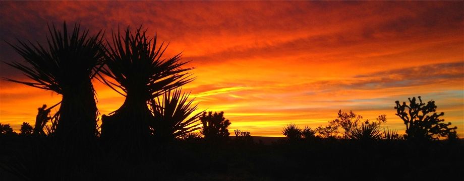
Photo by Buck Nelson
For a long time the desert was just looked at as the place where you dump waste, you put military bases, you run your motorbikes all over the place, you mine it and leave a big mess. It's important to get people to understand that the desert is a beautiful and complex place and also that it's a place that's worth preserving. There are very few people who will destroy a place through which they have just carried a 60-pound pack for three days. - guidebook author Steve Tabor
The Desert Trail is more of a route than a trail. Conceived by Russell Pengelly, the Desert Trail Association (later in collaboration with the Desert Survivors) worked to develop the route with the ultimate goal being a National Scenic Trail from Mexico to Canada. The official route currently runs from the California-Mexico border through California and Nevada, and ends in southeastern Oregon, around 1500 miles total. Nelson hiked the route, then continued on via a route of his own design through Oregon, Washington and Idaho, to the border with Canada, a total of 2223 miles. Nelson pre-set dozens of food and water caches for the first 1000 miles, returned (by car) to the Mexico border to retrieve the caches, then laid out 20 more caches in northern Nevada and part of Oregon.
Nelson provided the following useful links about his hike and the Desert Trail:
bucktrack.com/Desert_Trail_Thru-Hike.html (Introduction with some historical info on the route)
bucktrack.com/The_Desert_Trail_Map.html (Map)
postholer.com/Colter (Journal)
bucktrack.com/Desert_Trail_Guide_Books.html (Guide Books)
bucktrack.com/Desert_Trail_Gear_List.html (Gear List)
The route is mostly cross country walking through desert, washes, across dry lake beds and along ridge lines. In places the route follows wild horse and burro trails and 4WD trails. In some places the route follows gravel roads. Most “road-walking” is in places where vehicles are rarely seen... Obviously hiking over 2,000 miles is considerable work any way you cut it, but although there are hundreds of miles of cross-country travel most of it is fairly easy going and there is less climbing than on any of the well-known “Triple Crown” trails. - Buck Nelson
The Desert Trail passes north from the Mexican border through the deserts of California, Nevada, and Oregon. It is not a constructed trail, but a hiking corridor the hiker/backpacker may use to access some of the West’s most remote and fascinating territory. The California Section of the Desert Trail passes through four parks and seven Wilderness Areas in the southeastern corner of the state… The Nevada section of the Desert Trail passes through ten Bureau of Land Management Wilderness Study Areas and two National Wildlife Refuges in the western third of the state." - Steve Tabor
The idea for the Desert Trail is you take your compass and walk from one waypoint to the other. A waypoint is a place we have set aside to say 'this is where you are now' and you point your compass to go to the next waypoint. - Steve Tabor
This is a record that can be rather "easily" broken by an experienced hiker in good shape. - Buck Nelson
Photo by Buck Nelson
