|
|
Post by Peter Bakwin on Jun 12, 2010 11:22:56 GMT -5
Michael Versteeg set the supported FKT at 15d22h39m, October 3-19, 2016.Heather Anderson set the self-supported (thru-hiker) FKT & women's overall FKT, 19d17h9m (SoBo), October 7-27, 2016.An anonymous hiker has the men's self-supported (thru-hiker) FKT, 21d14h16m, April 20 - May 11, 2011."The Arizona Trail is an 800+ mile recreation trail from Mexico to Utah that connects mountain ranges, canyons, deserts, forests, wilderness areas, historic sites, trail systems, points of interest, communities, and people. It serves dayhikers, backpackers, equestrians, mountain bicyclists, trail runners, nature enthusiasts, cross-country skiers, snowshoers, and mule and llama packers." (From www.aztrail.org) The AZT is designated as a National Scenic Trail. Currently, just about 35 of the trail's 800+ miles remain to be linked, as indicated on this map. An email from the anonymous previous self-supported FKT holder gives a run-down of some previous FKTs on the AZT: "In 2007 I bested Li Banfors time of 35 days and some change. I am not sure Li was going for a record, but when I set out in 2007 that was the time I was hoping to best. April 8th 2007 - May 7th 2007 with a time of 30 days 7hrs 30 minutes. This was record was broken spring of 2009 by Matt Signore aka Worldwide with a time of 28 days 22hrs. I chatted with Matt after the trip to verify and I felt comfortable with the fact that he had indeed walked an unsupported speed record of the AZT." (A link to the hiker's AZT trail journal was given, but the journal has been removed.) The anonymous hiker went back to the AZT in the spring of 2011 and demolished Signore's time, completing the trail in 21d14h16m. His trip was mostly classic thru-hiker style, but he literally ran for the first 4 days with ultralight gear before switching to backpacking. He also walked to all resupply points. (A link to a complete TR on the hiker's blog had been given, but has been removed.) All previous FKTs on the AZT were smashed by Michael Versteeg, who ran the route in fully supported style in 15d22h39m, Oct. 3-19, 2016. This trip was reported on Versteeg's Twitter feed, and tracked on trackleaders.com. Interestingly, Heather Anderson was on the AZT at the same time as Versteeg, going in her typical thru-hiker (self-supported) style. She completed the route with a new FKT for that style, and new women's overall FKT of 19d17h9m (SoBo), from 4:17pm on Oct. 7 to 9:26am on Oct. 27, 2016. Her lengthy, detailed report is here. On December 20, 2015, Kathy & Ras Vaughan completed the first known out & back (yo-yo) of the AZT in a total time of 93d6h22m and using classic thru-hiker style (self-supported, no rides). The couple started at the Mexico border on September 18 and reached the Utah border on November 4. More details are given below by Ras Vaughan. 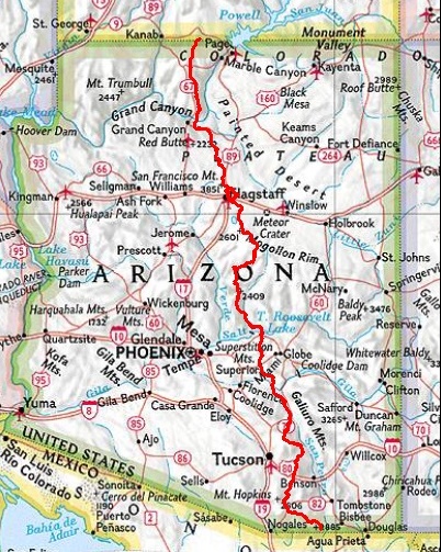 
|
|
|
|
Post by greenbear on Mar 10, 2011 13:01:34 GMT -5
I am attempting to break Matt Singnore's AZT record of 28 days 22 hours. I'm starting at Mexico the morning of Monday, March 14th. I'm hiking unsupported.
|
|
|
|
Post by greenphone on Apr 11, 2011 22:47:36 GMT -5
I met greenbear as he hiked down the South Kaibab on Saturday, 9 April 2011. He looked to be in great spirits on his trip to Utah.
|
|
|
|
Post by greenbear on Apr 12, 2011 9:23:23 GMT -5
Set the new Arizona National Scenic Trail speed record yesterday, started on Monday, March 14th at 6:30 am in Mexico and walked every step reaching Utah on Monday April 11th at 7:00pm, I'm gonna round the half hour up for a nice even time of 28 days 13 hours. My real name is Kirk Barrett, I live in Zion National Park, gonna post some pictures from the hike on my FB page it's set to private but ill friend anyone that mentions the AZT. It was a wonderful hike that went incredibly smooth. I set my sights on getting just below Matt Singnore's record, not on pushing hard every day to beat it by days. My pace felt fairly relaxed, night hiked at least a couple hours most nights though. Took one rest day with my lovely girlfriend in Flagstaff. So any way this record will not be too hard to beat, somebody out there go get it next spring, it's a beautiful, diverse, and challenging trail. Had to do some snowshoeing across the San Francisco Peaks the South Rim and the North Rim.
|
|
|
|
Post by worldwide on Apr 18, 2011 23:41:14 GMT -5
rst of all, I want to apologize for the delayed response. Secondly, what I consider "right" or "proper" is what I expect from me not others. Lastly, the debate involves 2 people I like and respect with me stuck in the middle.
The controversial section involves the N Kaibob trail. I encountered on average 3 ~ 4 feet of "settled" snow. It wasn't too fresh, and had a "walkable crust". Most of the trail stays inside the trees, and they offered enough shade to maintain a "walkable crust". Where the trail leaves the trees into open areas I had to skirt along treelines to use the shadows cast by said trees in attempt to find stronger snow. There was a trail closure due to a previous fire. I ignored the closure in direct violation of some article and law punishable by some fine or whatnot. It wasn't actively burning, and I wasn't too worried. This area was a cakewalk compared to the Willow fire area in the South.
That being said I did not use highway 67 to complete the AZT.
The question has been raised because of Greenbears AZT hike, and his use of hwy 67. Personally I feel that avoiding snow is best done by a later start date not by relocating a trail every heavy snow year. Sadly Greenbear had a heavy snow year, and I believe he was getting snow during his hike. Where in 09 there was only a few inches during one night when I was on the N Kaibob. I am a purist, and I relish in the challenge of can I or can't I do something. Under heavy powder I don't think I could have completed without using highway 67 let alone set a record. Fortunately I had some better conditions than this season offered.
This will hopefully become a moot point, and Krud Meister will hit his mark of 18 days (you sick bastid). Have a great time, be safe, and keep that fire inside you stoked.
Matt "Worldwide" Signore
727.255.4004
|
|
|
|
Post by greenbear on Apr 18, 2011 23:51:40 GMT -5
I completely agree with The Krud. The Record holds with Worldwide. I walked every foot of the real signed AZT except for taking closed Hwy 67 from the N. Kaibab Trail and got back on trail where it crosses the Hwy again just north of Jacobs Lake, where I had a lovely breakfast. Yeah, I even had snow shoes on my back and trying to hunt out the trail tread in that much snow did'nt seem like much fun at all. It was a beautiful hike though. I wish Krud luck on his hike finding the "true" trail as there are several gray areas as to the one true trail. Such as in the Santa Catalina's there is a route through Canada Del Oro or an also signed route through Summerhaven and down the Oracle Ridge Trail I think it is. Both routes are signed and I think the data book uses the Summerhaven route which is def. easier, I've done both. The other gray area is dead end singed new single track construction north of oracle, I walked about 2 miles up signed new single track to the top of a ridge only to have it dead end and have to back track down to the dirt road route, also signed but with older signs, does one need to walk this dead end, since it is the future true route of the trail and continue bush whacking, to be walking every foot of the true route? Also 2 routes from the Gila River to the Artesian Spring, to follow the future route of the trail involves off trail flag following ,this would be the route I would vote for. Also the Flagstaff Re-supply route is that the true route , originally the trail just had the eastern route the flag route is a re-supply route, so to be on the true route must one back track to the eastern route around flagstaff? I find a straight line to be far more enjoyable and less neurotic as well. Looking forward to following Kruds hike!, remember the one beer with the Mormon Lake buffalo rule on your hike Krud or I'll be forced to declare it unofficial. Just kidding. Greenbear
|
|
krefs
New Member

Posts: 1
|
Post by krefs on Oct 28, 2011 15:54:32 GMT -5
Hey all. I just stumbled across this thread. For those of you that are interested in faster forms of transportation, I rode the Arizona Trail in May 2010 from South to North in 7:06:35 (D:HH:MM). I followed the official route for the Arizona Trail 750 bike race, which sticks to the AZT as much as possible, detouring around the west side of the Santa Ritas to avoid that wilderness and following a mostly dirt road route from just north of Picketpost to Payson. I was forced to take a short detour around deep snow at Mormon Lake and the highway from the North Rim to Jacob Lake. I'm sure 12+ hours can come off that time, but for the first attempt at that route, I was pretty dang satisfied. If you're looking for a different kind of unsupported adventure, I highly recommend riding this route, aside from the Highline Trail and the rather arduous bike portage across the Big Ditch. For more info on the race, check out www.topofusion.com/azt/race.php. Last year, one guy gave the AZT300 (Parker Canyon Lake to Picketpost) on foot. He had some bad luck and didn't get too far, but the bike records are something like 2:09 for men and 3:04 for women. Kurt Refsnider |
|
|
|
Post by Chloe on Oct 28, 2012 15:02:00 GMT -5
I don't see any FKT for women on the AZT...is that because there isn't one? or is it just not up here? I've done some fairly extensive internet searching and haven't come up with anything.
|
|
|
|
Post by Vitalis Maximus on Nov 11, 2013 13:32:25 GMT -5
I don't see any FKT for women on the AZT...is that because there isn't one? or is it just not up here? I've done some fairly extensive internet searching and haven't come up with anything. |
|
|
|
Post by Ras Jason Vaughan on Apr 7, 2014 15:52:36 GMT -5
Starting the morning of Tuesday, April 8th, 2014, at the Mexico border, my wife Kathy and I will be attempting to set a new FKT on the Arizona National Scenic Trail. Our main goal is to have a great time and experience Arizona in a way that even few residents get to. Our secondary goal is to set a new overall FKT. Failing that, Kathy hopes to set the women's FKT. We will be carrying a SPOT transponder which can be viewed at: epic.voyage Also, I will be posting updates whenever possible on my personal Facebook page at: www.facebook.com/JahsonItesAfterwards we will post a detailed trip report on UltraPedestrian.com |
|
|
|
Post by Ras Jason Vaughan on May 14, 2014 21:37:39 GMT -5
OFFICIAL AZT THRUHIKE TIME 35 DAYS 5 HOURS 2 MINUTES: Kathy and I departed the Mexico Border at the southern terminus of the Arizona National Scenic Trail (after a <2 mile approach hike) at 7:24 AM on Tuesday April 8th, 2014. We arrived at the Northern Terminus at the Utah state line at 12:26 PM on Tuesday, May 13. Our journey was bookended by epic all night pushes. The first was a 26 1/2 hour and 55 mile section from the beginning to Patagonia, AZ. The second was a final effort of 64.5 miles that took 29+ hours and concluded at the northern end of the AZT.
Obviously, we came nowhere near the overall record, but we did announce Kathy's intention to establish the first women's speed attempt, and provided a link to our SPOT tracker, as well as posting updates as we went on Facebook. It would have to be considered supported, because we hiked as a team and I carried shared gear such as our sleeping bag, tent, and water. We also accepted rides into town on 5 occasions to buy food, as our mail-ahead caches were prepared based on a lot fewer days on the trail.
The AZT is a very challenging trail, and the times pulled off by Krudmeister, Greenbear, and Worldwide are astounding. If the word 'kudos' were still in parlance I would say, "Kudos to you all." Instead, I say Big Up and Maximum Respect.
MACGYVER MOMENT: We were traveling stoveless and soaking our dehydrated food and enjoying it just fine, But cold instant coffee in the more was found to be sorely lacking as a pick-me-up when it actually leaches heat from your body. So I decided to try a reverse hot water bottle experiment. I put 1 liter of water in a 2 liter Platypus Unbottle (so it would spread out, have more surface area and less thickness) and stuck it down the leg of my puffy down pants before I went to sleep. From that point on, in the morning we had 98 degree coffee instead of 40 degree coffee, which is a substantial upgrade.
|
|
|
|
Post by alaska on Nov 25, 2014 20:01:06 GMT -5
Congratulations to all the AZT speedsters out there. No wonder I found it impossible to keep up with Worldwide on the PCT!
|
|
|
|
Post by Birdbath on Dec 8, 2014 14:05:36 GMT -5
Yo!
Got the chance to have an extended on-trail chat with Bink on the PCT this year at Windigo Pass, just as he made the tough call to take a forest road off-trail, ending his speed attempt due to the fires near the CA/OR border and his aversion to re-routing on smoked-out roads through hell-scapes for miles and miles.
Inspiring dude.
Trying to get to Seattle after completing my thru-hike, a group of us stranded in Winthrop, WA got a hitch - just as we were calling it a fail - from none other than Anish. During the 2 hours she drove us closer to Seattle, we talked about (hmm...) her new, badass record and her experiences setting it.
Inspiring lady.
Perhaps consequentially, I'll be attempting the AZT unsupported speed record this spring. I'll be hiking north from the Mexican border on March 26th, 2015 (snow-pack dependent).
Any help/advice from past record-attempters would be invaluable in the coming months of prep.
Onward and Upward!
Thanks!
|
|
|
|
Post by Tyler Michael on Sept 15, 2015 18:50:11 GMT -5
Does anybody know if Adam Bradley's time of 21d14h still stand as the fastest known time?
|
|
|
|
Post by Ras Jason Vaughan on Sept 17, 2015 22:49:18 GMT -5
Blessings, Every One! Beginning tomorrow, Friday September 18, 2015, Kathy and I will begin our attempt to yo-yo the Arizona National Scenic Trail. We will begin at the southern terminus at the Mexico border, make our way to the Utah border, then turn around and make our way back to the southern terminus. We hope to complete the trip in 70 days. Kathy also has the ambition of bettering her Women's FKT on either the northbound or southbound leg of our adventure. Our progress can be monitored on our SPOT transponder page at: share.findmespot.com/shared/faces/viewspots.jsp?glId=0zQbUiFUjuCCJeFY2yq29RzaWBqsNfFqpand I will be posting updates to my facebook page throughout the journey at: www.facebook.com/JahsonItes |
|


